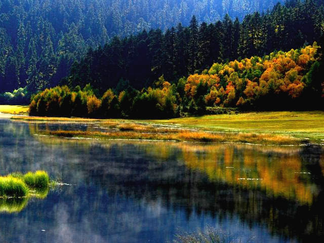
Glacier and forest climate in Shangri-La
5 min readNitong Village Roofs, Deqin County
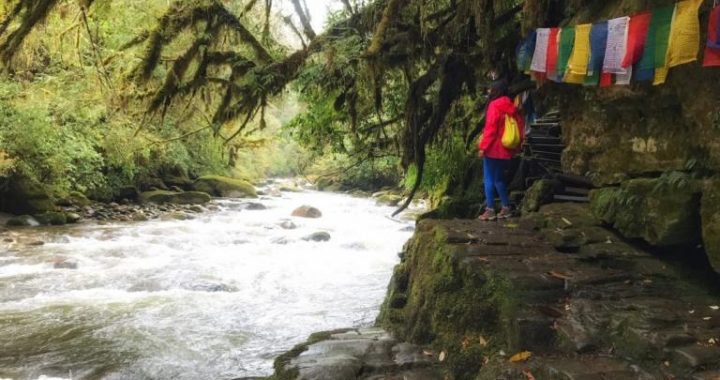
Retreating glaciers can have impacts on communities, such as water supply and landslide hazards; however, illustrated here is a more direct effect of changing climate. It is also a great example of how societies adapt to changes in their physical environment. Nitong village lies along the Lancang River at the point where the high peaks of the Khawa Karpo Range give way to lower summits and ridges. Just to the north, these high peaks intercept monsoon systems and dramatically reduce rainfall leeward in the adjacent valley. Known as a rain shadow, this creates an arid environment locally. Without peaks to block the rain, the valley south of Nitong is muchmore humid, with forests descending all the way to the river. The village of Guonian lies in the rain shadow to the north, while Ciku lies in the humid zone to the south.Joseph Rock’s 1923 photo of Nitong shows a village much more like Guonian, with flat, open roofs used for drying crops. Due to the relativearidity, there is no need to worry about rain. In fact, Rock photographed this scene to illustrate the just-harvested corn being dried on the roof in the center of the image. Today, most houses in Nitong have pitched roofs covered with shingles. Crops are still dried on the top floor, but apparently there is now more of a need to protect them from rain. Currently, the flat-roofed houses begin two villages north of Nitong and continue up the Lancang River onto the Tibetan Plateau. South of Nitong all houses have pitched roofs. With no weather station in the area we don’t know for sure whether this shift in the boundary between flat-roofed and pitched-roofed villageshas to do with a change in climate or other cultural and economic factors.But changing precipitation patterns are projected to be one consequence of a changing climate, in addition to increasing temperatures.

Rising Forests of Baima Snow Mountain, Deqin County
Remaining sequences illustrate the ecological impacts of a rapidly changing climate and, by extension, the impacts on traditional Tibetan livelihoods.The upper treeline is also something that is highly visible in photographs, and Joseph Rock has again provided some great baseline photos with which to observe and measure the impacts of warming temperatures.As Rock headed back to his Lijiang home after a two-month expedition, he traversed the passes east of Baima Snow Mountain on a clear day taking many photos along the way. We relocated his photo points exactly 80 years later on an equally stunning day. We found here and elsewhere that forests are moving up the mountainside. In this scene, many larch trees(Larix potanini) have become established in the alpine meadows where none were visible 80 years before. Although they look dead here, larch is actually a deciduous tree and has lost its needles for the winter.
Rising Forests of Baima Snow Mountain, Deqin County
As he crossed Baima Pass, Joseph Rock understandably focused his photography on the spectacular Baima Snow Mountain. Inadvertently, however, he sometimes captured other features that today are of greater interest to ecologists. Such is the case here, where he captured a ridge in the foreground that turned out to be important to the study of how climate changes are affecting local biodiversity and Tibetan livelihoods. Specifically, scientists from The Nature Conservancy were able to use the repeated photos to measure the rate at which forests are moving up the mountain and invading alpine meadows.Rock’s 1923 image of the ridge shows a zonation from closed-canopy forest (CF) along the bottom of the photo, giving way to widely scattered tres(ST) near the ridge line, and finally to alpine meadow (AM) above the last tree. Today, the entire ridge is covered with a closed-canopy larch forest. The upper treeline has movedup the ridge out of view to the right. Using Rock’s photo as the baseline, we measured the rate of up-slope movement of the forest to be a prodigious 10 meters(33fet) in elevation per decade during the past 80 years.
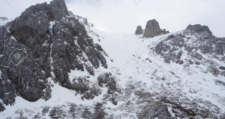
Upper Treeline at Baragong Pass,Gongshan County
Joseph Rock was traveling across the mountains between the Catholic missions of Cizhong on the Lancang River and Baihanluo in the Nu River valley. Before descending to Baihanluo he photographed this scene at the upper treeline in Baragong Pass, which lies about 50 kilometers(31 miles) southwest of the previous photos at Baima Snow Mountain. This scene beautifully illustrates close-up the increasing forest cover in the scattered-tree zone that we saw at Baima. Fir trees(Abies georgei) have become more abundant throughout the center of the photograph, while a tall rhododendron species(Rbododendron trailianum)has increased in the foreground.
Increasing Shrublands at Baima Pass, Deqin County
We are well above the forest here at the summit of Baima Pass, the divide between the Lancang and Jinsha Rivers. The scene encompasses all three components of the alpine mosaic: meadow, shrubland, and rocky scree around the peaks. Of interest in this scene is the foreground, where three species of dwarf rhododendron(Rbododendron tapetiforme,R. nivale, and R. rupicola) have increased dramatically during the past 80 years, at the expense of the alpine meadow. Arrows point to a rock as a point of reference.Research from other alpine and arctic regions of the world has shown thatthis increase in woody vegetation(trees and shrubs) results from a warming climate.Research in alpine ecosystems of northwest Yunnan discovered that alpine meadows have the highest plant diversity of any Tibetan habitat. Alpine meadows also provide Tibetans with most of their medicinal plants and are the areas where the highest yak butter productionoccurs. In other words, forest and shrubland encroachment into these meadows caused by a warming climate is resulting in a decline in both biological diversity and in Tibetan livelihoods. For at least a century, and probably much more, yak herders have successfully used fire to limit woody plant encroachment and maintain alpine meadows. This practice is now outlawed. Government conservation managers need to become aware of the effects of a rapidly warming climate on the biodiversity that they are responsible for, as well as on the economic and cultural well-being of local communities. They must adapt by redesigning their programs to accommodate this inevitable change.