Glacier climate in Shangri-La
5 min readGlaciers of Khawa Karpo, Deqin County
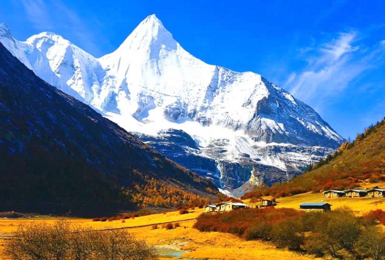
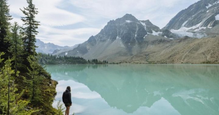
The mountain scenery of the Khawa Karpo Range has become a popular atraction on the Shangri-La tourist circuit during the past decade. Thousands photograph its peaks and glaciers from the popular tourist overlook of Feilaisi. But somehow,70 years earlier, Joseph Rock found the best view of all at a lonely Buddhist prayer site on a ridge high above the Lancang River.The entire 4,700-meter (15,400-foot) river-to-summit gradient is strikingly clear across the narrow valley. Rock thought the view so remarkable from this vantage point that he returned again three weeks after his first visit to capture the scene on a cloudless day. In all, he shot 20 frames from this point, more than he ever shot at any other photo point in northwest Yunnan.Highlighted in this sequence are two serpentine glaciers snaking down from the peaks, the longer Mingyong Glacier descending from Khawa Karpo’s summit on the left and Sinong Glacier on the right. Both glaciers exhibit considerable loss in ice volume along their lower reaches. This is easiest to see where cliff bands have become exposed during the past 80 years, indicated with arrows on the modern image. The next two photo sequences take us close-up along the lower reaches of the Mingyong Glacier in the vicinity of the arrow.
Mingyong Glacier at Taizi Temple,Deqin County
Here we are lucky enough to view an incidental time series of four identical photographs of Mingyong Glacier. In 2004, we rephotographed Kingdon-Ward’s 1913 image behind Taizi Temple. Later I discovered that our friend Fang Zhendong, director of the Shangri-La Alpine Botanical Garden in Zhongdian, had photographed the same scene during a botanical expedition in 1994 and published it in his book on Khawa Karpo. In 2009, Brook Larmer volunteered to rephotograph the scene while on a reporting assignment for National Geographic magazine. So, instead of the usual two points in time, we now have intermediate points that give us the rareopportunity to view differing rates of change in Mingyong Glacier during the past century.In the 80 years between 1913 and 1994, there is no visible loss of ice volume. The next 10 years, however, saw dramatic changes as a large cliff band emerged through the thinning ice. Compare this to the Joseph Rock photos in the previous sequence, where we see just the beginning and end of the 80-year period, but have no idea that most of the loss took place in the past 10 years. From 2004 to 2009 there was no appreciable ice loss, but the surface is now an ugly gray color due to the accumulation of gravel emerging from the declining ice. This surface change is even more dramatically illustrated in the next photo sequence.
Mingyong Glacier Terminus,Deqin County
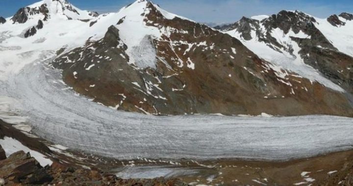
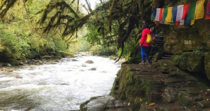
The previous views of Mingyong Glacier illustrated the overall loss of ice volume. The scene for this triptych lies 1 kilometer (0.6 mile) below TaiziTemple and illustrates the up-valley retreat of the glacier terminus. Even with poor image quality, the 1913 scene shows a bright, healthy river of ice filling the valley. Kingdon-Ward captioned the scene an “ice cataract.”By2002, ice still fills the valley bottom, but there is much less and it cannot be characterized as a cataract. The surface has turned gray as gravel emergesfrom the retreating terminus and concentrates on the surface. Two years later there was a surprising loss of ice, so much so that we had trouble recognizing the scene. No ice is visible under the thick coating of gravelly debris, and the very terminus of the glacier is almost in view. Today there is no glacier at all in this scene.Tibetan Buddhists consider Khawa Karpo to be sacred, the home of a fierce warrior god. Because Mingyong Glacier descends from its summit, it is also considered sacred, and two temples are located along its edge.A monk from Taizi Temple reflected on the rapid retreat of Mingyong Glacier, concerned that it may be punishment from Khawa Karpo for the lack of devotion by him and his fellow Buddhists. This spiritual angst is obviously misplaced, but unknown at this isolated outpost is the near-universal retreat of the world’s glaciers as a consequence of rapid climate change.
Landslide on Yulong Snow Mountain,Yulong County
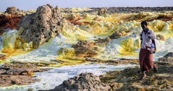
Next we have two photo sequences of the glacier that descends the southside of Yulong Snow Mountain. Together, they uniquely illustrate not only glacial retreat, but also the catastrophic consequences that can result from rapidly retreating mountain glaciers.The first sequence is of the glacier’s terminus on the valley floor. Joseph Rock’s 1923 photo captures a small piece of the glacier’s terminus(arrow)and a full view of the lateral moraine, the distinctive ridge of gravel in the middle of the photo pushed up by the glacier as it moved down valley.During the intervening 80 years, this glacier retreated rapidly out of view, leaving behind a steep valley filled with unstable, rocky debris. In April 2004, just one month before our visit, this debris and possibly part of the glacier swept down the valley in a violent landslide that filled the valley bottom with more than 20 meters (65 feet) of rock. Obviously, we were unable to occupy the same photo point, but you can see the light-colored landslide debris that swept over the moraine and filled the foreground.
Landslide on Yulong Snow Mountain,Yulong County
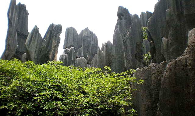
The second photo set of the Yulong landslide gives a full view of the steep valley above the terminus. From Handel-Mazzetti’s 1915 vantage point, we can see that the glacier descended from the summit to the valley floor where Rock took his photograph eight years later. In 2008, astronauts aboard the International Space Station took a stunning photograph of the entire Yulong massif from an elevation of 350 kilometers (217 miles).A blown-up portion from the southern end of the range shows the path of the giant landslide. A small remnant glacier is now relegated to the summit ridge, with no glacial ice visible anywhere in the lower part of the valley. As is typical of rapidly retreating glaciers, it left behind an unstable landscape that eventually gave way in one episodic event in 2004.