Water resource in xinjiang
10 min readPeople all agree that water is the source of life.
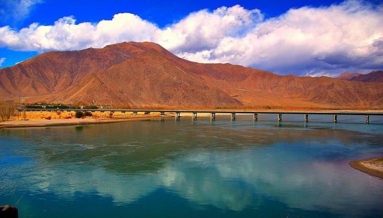
In Xinjiang, there are over 570 rivers of different sizes, over 270 mineral springs and over 100 natural pools of different sizes. During the 21st century, the overall volume of the annual average water resources of Xinjiang is 93 468 billion m³, including surface water resource volume of 88 269 billion m³, ground water resource volume of 58 222 billion m³ and repeated measure of surface water and ground water is 53.022 billion m³ ; and per capita water resource volume 4,697.91 m³. In 2010, the overall water resource volume of Xin jiang is 112.4 billion m³, including the surface water resource volume 106.3 billion m³ , the ground water volume 62.43 billion m³ and the repeated measure of surface water and ground water 56.32 billion m³; the exploitable yield of ground water 25.2 billion m³; the glacier reserves 2,134.9 billion m³ , accounting for 50% in China; per capita water resource volume reaches 5,120 m³. Surface water and ground water can be converted into each other and recycled with the recycle rate up to 130% ~ 150% of the water volume at the water outlet.
The climate of Xin jiang is continental climate featuring dryness with less precipitation and uneven distribution; the precipitation in Northern Xin jiang is more than that in Southern Xin jiang, in the west more than in the east, and in mountainous areas more than in basins. The regions with annual precipitation over 300 mm are mostly located in mountainous areas; and the annual precipitations of Tianshan Mountains, Aral Mountains and the Altai mountains about 500 mm, close to that of North China Plain; the annual precipitation of the north slope of Tianshan Mountains about 215 mm and the annual precipitation of the south slope of Tianshan Mountains about 75 mm, At Toksun weather station in Turpan, the precipitation is less than 10 mm, where exists the minimum annualprecipitation in China; the precipitation of li Valley is 250 ~ 350 mm, which makes it a region in Xinjiang with relatively abundant precipitation.
The precipitation of most regions in Xinjiang mainly occurs during spring and summer: in Southern Xinjiang and Tianshan Mountains, it mainly occurs in summer; in the west of Northern Xinjiang and the area along Tianshan Mountains, the difference of precipitation in spring and summer is not large. In terms of monthly distribution, the precipitation of Southern Xin jiang and Tianshan Mountains area occurs collectively in May to August, while the precipitation of Northern Xin jiang occurs collectively in April to July.
The water resources of Xinjiang originate from the mountain areas; the annual precipitation of the mountain areas accounts for over 80% of the total annual precipitation of Xinjiang. The precipitation in alluvial fans below mountain passes and plains, Gobi, deserts and other areas, almost totally leaks and evaporates, normally without runoff, therefore the surface water resources of Xin jiang substantially generate from mountain areas. Thus, if the precipitation in mountain areas is abundant, the water resource supply of Xinjiang will be guaranteed.
The recharge sources of the rivers in Xinjiang are mainly seasonal melted snow andprecipitation, and the glacier melted water is less. Besides, the recharge proportion difference of the runoff volume of all mountain rivers is large. The rivers of the AltaiMountains are mainly replenished by seasonal melted snow and rainwater, while the rivers of Kunlun Mountains are replenished by glacier melted water mostly. Among the more than 570 rivers of Xinjiang, there are altogether 18 rivers with annual runoff volume over 1 billion cubic meters, whose annual net flow accounts for about 60% of the total net flow of all rivers in Xinjiang;487 rivers with annual runoff volume below 100 million m³, whose annual net flow accounts for about 10% of the total net flow in Xinjiang.
The surface water resources of Xinjiang are mainly distributed in mountain areas. In terms of water yield in all mountain areas, the water yield of Tianshan Mountains has the most, exceeding 50% of the total volume of Xinjiang; south of the Kunlun Mountains ranks the second, accounting for 30% of the water volume in Xinjiang; the water yield of the Altai mountains in the north and the western mountain areas in Junggar accounts for 20%.
Divided by the ridge of Tianshan Mountains, the water yields in Northern Xinjiang and in Southern account for about half and half respectively However, the land area of Northern Xinjiang only accounts for 36% of the total area of Xinjiang, while Southern Xinjiang accounts for 64%. Therefore, the water yield of the unit area in Northern Xinjiang is aboutone time more than that in Southern Xinjiang. Thus, the water resource distribution is very unbalanced presenting a situation of “rich North and poor South”. Divided by Cele-Yanqi-Qitai, the southeastern part and northeastern part of the areas along this line are roughly equivalent, but the water yield of the northwestern part accounts for 93% of that of Xin jiang, and the southeastern part only accounts for 7% which fully indicates that thewater resources between the northeastern part and southeastern part of Xin jiang differ greatly; the water resources of the northwestern part particularly concentrate on two ma jor rivers-17 billion m³ in li River Watershed,11.9 billion m³ in Irtysh River, accounting for 32.7% of the surface water resources of Xin jiang in total.
Another feature of the surface water resources in Xinjiang is the large discrepancy among seasons within one year, but the inter-annual variation is fairly stable. In terms of seasons, the water volume of the rivers in Xinjiang concentrates on the whole; normally, the water volume in summer(June to August) accounts for 50%~70% of the annual water volume; in spring and autumn accounts for 10%~20% respectively; and in winter accounts for10%.
If we make statistics according to the administrative division, the groundwater resource distributes as follows: counties and cities directly under lli Prefecture, Kuqa and Shaya in Aksu Region, as well as Wensu, Awat and Aksu and other counties have abundantground water with the average recharge modulus exceeding 300 thousand m³/km²; and then it is Shache(Yarkand), Zepu, Bachu, Makit and Yecheng in Kashgar District, Moyu, Luopu, Cele, Keriya, Jinghe, Wusu and Kuitun in Hotan Prefecture, all counties in Changji Prefecture, Kashgar City in Kashgar Prefecture with the average recharge modulus 100 to 200 thousand m3/km2; and at last, Karamay and Qiemo, Ruoqiang and other counties in Bayangol Mongol Autonomous Prefecture rank the third with the average recharge modulus less than 100,000 m2/km2. If Xin jiang is divided by the ridge line of Tianshan Mountains into two parts, the groundwater recharge amount in Southern Xinjiang accounts for nearly 60% of the total amount of Xinjiang, while that in Northern Xin jiang accounts for about 40%.
We can say that the water bodies in Xinjiang mainly include water in the air, precipitation, runoff and groundwater and so on. Xin jiang is surrounded by mountains and far from the sea, but the relative humidity of the air in Xinjiang is about 50%, not as arid as people imagine. The average water content in the air column of Xinjiang is about 10 mm, which is not so different from that of other regions at the same latitude. Every year, the water vapor flowing across Xin jiang is at the order of magnitude of about 1 trillion tons.The water vapor in Xinjiang mainly comes from the west, which is the source of precipitation in Xin jiang. Wherever water is in critical shortage, water for production and livelihood can be obtained from the water vapor in the air directly as long as the energy resources are abundant.
Precipitation is mainly represented by abundant rainfall in the mountain areas. Either inthe Altai Mountains System in the north, or in Kunlun Mountains System in the south, or in Tianshan Mountains in the middle, there are areas with abundant precipitation in middle regions and alpine regions. The precipitation in mountain areas is more than that in basins which is a significant feature of the climate in Xin jiang; low precipitation decides the arid features of the basin regions in Xin jiang. In addition, the precipitation in the west of Xin jiang is more than that in the east, in the north more than that in the south. In terms of the four seasons, the precipitation of Xin jiang mainly concentrates in spring and summer. The precipitation in the mountain areas during June to August can account for 70% of theannual precipitation, but at that time in high mountain area, it is still mainly snowfall.
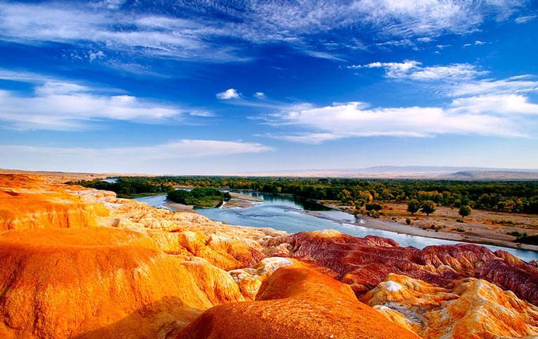
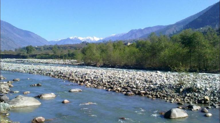
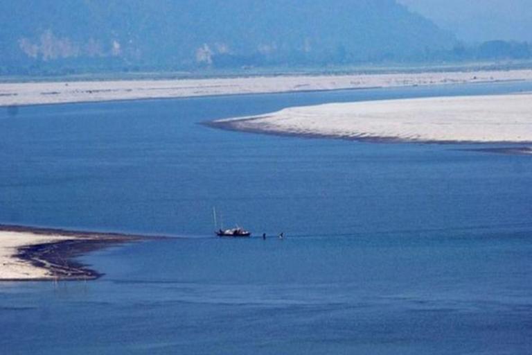
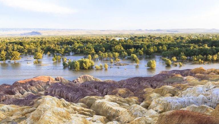
Over 570 rivers and runoffs in Xinjiang originated from mountain areas, which are the major water sources for farmland irrigation in Xinjiang. Two basins, Junggar and Tarim, decide determine that the rivers originating from mountainous areas will gradually disappear on the rim of the basins, while big rivers can form lakes at the end of the rivers (such as Ebinur Lake, Ulungur Lake and Bosten Lake, as well as Lop Nor which is already dried-up). Therefore, the fact that most rivers are inland rivers is the significant hydrologic feature of Xinjiang. The features of the runoffs in Xin jiang are similar to that of the precipitation; there are more runoffs in mountainous area than in basins, more in the west than in the east and more in the north than in the south. The runoff volume in the Altai Mountains System maximizes in late spring while the water volume of all rivers in Tianshan Mountains and Kunlun Mountains System maximizes in summer. The total lake area of Xin jiang is around 5,000km2. The permanent firn and glacier of Xin jiang covers an area of more than 20,000km2, accounting for 41% of the ice and snow area in the whole country.The total glacier and snow cover amount in Xinjiang is 2 trilion tons, accounting for 43% of that of the whole country. Lakes are mainly located in basins or middle mountain regions.Permanent snow cover and glacier play an important part in adjustment on river runoffs.
In terms of topography and geologic structure, the groundwater in Xinjiang can be divided into mountain groundwater and plain(basin) groundwater. For the precipitation or the melted snow in mountain areas, other than the major part evaporating or becoming runoff, some first becomes groundwater in the mountain areas and then becomes river water before going out of the mountains. For the runoff volume of rivers at the mountain pass, more than 30% is transformed from the groundwater of the mountain areas. In addition, every year there are also some mountain ground runoffs which directly infiltrate into the basins, becoming a source of groundwater of the basins. The basin groundwater mainly originates from the infiltration in riverbed,canal system and farmland after the river flowing out of the mountains.The way out for plain groundwater is evaporation with the specific routes including being used for irrigation by people,or finally returning to the atmosphere through marshes,forests and lakes and so on.
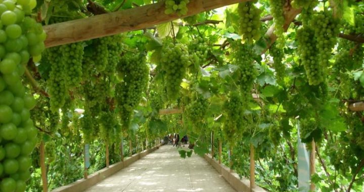
Speaking of groundwater,the karez in Turpan is the most famous example of using groundwater for irrigation,which is also the longest underground irrigation system.There are altogether nearly one thousand karez wells,about 5,000km long accumulatively.The structure of karez wells basically consists of vertical wells,underground channels,ground channels and water logging dams(small water reservoir).In Bogda Mountain in the north of Turpan Basin and Kalawucheng Mountain in the west,lots of snow and rainwater flows down the valley during spring and summer,and infiltrate into the Gobis.People make use of the slope of mountains and create karez wells ingeniously to channel underflow for irrigation.Karez prevents evaporation from the heat and the gale with a stable flow to ensure the gravity irrigation.Karez well is an ancient horizontal water collection construction to develop and use groundwater,which is suitable for mountain foot and alluvial fan rim areas,mainly used for intercepting groundwater for irrigation and livelihood.According to the statistics,there are altogether 1,700 karez wells,the total flow is about 26 m3/s and irrigation area is about 33,333 hectares.And most karez wells distribute in Turpan and Kumul Basin,for example in Turpan Basin,there are over 1,100karez wells with the total flow up to 18 m3/s,irrigation area 31,333 hectares and accounting for 67%of the total cultivated land of the basin.So it has significant meanings for developing local agricultural production and meeting people’s livelihood.Karez along with the Great Wall and the Beijing-Hangzhou Grand Canal are called the three Great Ancient Projects in China.
Karez-one of the three major projects in ancient China The evaporation of the arid region in Xinjiang is powerful.There are mainly three evaporative zones in Xinjiang.The vast desert and Gobi areas have neither surface runoff nor groundwater overflow,so the evaporative quantity can only equal to the local precipitation of not a big amount. This is a hydrological zone with the simplest evaporative features. It is opposite in the mountainous areas of over 700,000km-in Xinjiang: low temperature, much precipitation, precipitation more than evaporation, as the runoff formation area and origin of rivers. The most special hydrological regions are runoff dissipation area at the mountain foot. The rivers going out of mountain, channels, farmland, swamps, lakes and plain forests are where they locate. Here the temperature is higher than that in mountainous area and there is artificial or natural water recharge, so it is suitable for farming, and it is the agricultural region with coordinated hydrothermal resources. The underlying surface here is fairly moist. The evaporative quantity in this district is close to or equal to the evaporative capacity under fully moist conditions, whose value is about 1m deep every year. The runoffs of inland rivers mostly dissipate in this dissipation area.
Xinjiang is an arid inland region. Water is not only the source of life, but also the lifeline of oases. The distribution and utilization, to a large extent, determines the scale, speed and degree of the national economy and social development of Xinjiang.