Topography of “Two Basins Flanked by Three Mountains”
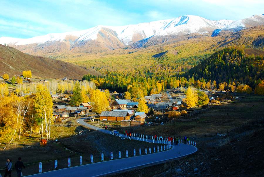
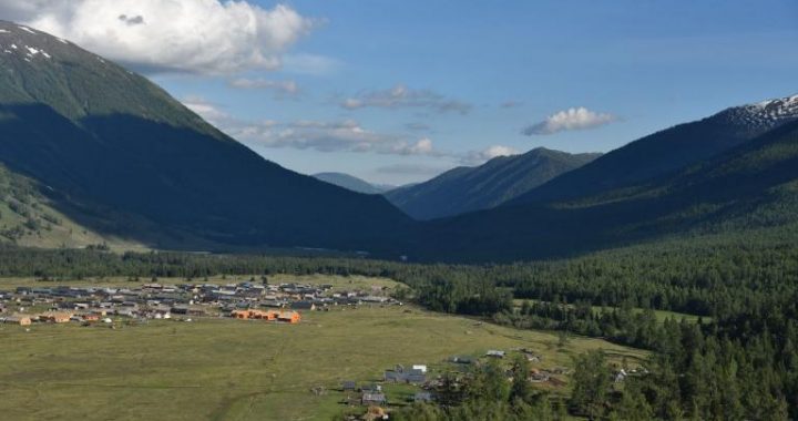
3 min readIntroduction One-sixth of China. the Biggest Province Xinjiang Uygur Autonomous Region is located in the northwestern border area of China and the heart of the Euro-Asia continent The region has an area of 1. 6649 million square kilometers, one-sixth of the entire size of china The land boundary in Xin jiang runs up to 5600 kilometers, about one-quarter of the nation’s total land borderline linking China with 8 countries altogether. Among all provinces and autonomous regions in the country, it is the one with the longest borderline and the biggest number of neighboring countries Domestically, Xinjiang borders on Tibet Autonomous Region, Qinghai Province and Gansu Province I Topography of “Two Basins Flanked by Three Mountains The entire region of Xinjiang features”two basins flanked by three mountains”. The “three mountains “refer to the altay in the north the Tianshan in the middle and the Kunlun and Karakorum in the south. The”two basins”are the Junggar in the north and the Tarim in the south. The Tianshan Mountains serve as an axis, dividing xin jiang into the northern and southern parts, each with distinguishing natural conditions. Customarily, the area around Turpan and Hami is also called Eastern Xin jiang The Tianshan Mountains are the biggest mountain system in Asia, running about 2,500 kilometers east-west and 250-300 kilometers north-South. They are a combination of threeroughly parallel mountain ridges, which produce a number of depressions and valleys with varying size and height, such as li Valley, Major and Minor Yoledus Depressions, Yanqi Depression, Turpan Depression and Hami Depression. The highest point of the Tianshan Mountains is tomur peak. 4355 meters above sea level: the bogda peak stands at a height of 5, 445 meters to the east of Urumqi. The Turpan Depression at the eastern end of theTianshan Mountains is the lowest point on land in China, 154 meters below the sea level The Altay Mountains are also known as the Gold Mountains for rich reserve of this precious metal there. The main body of the Altay Mountains is in Mongolia, running about 400 kilometers from northwest to southeast, with an average altitude of 2,000 to over 3.000 meters The highest point is Youyi peak. 4 373 meters above sea level both the Kunlun and Karakorum Mountains originate from the Pamirs and wind their way eastward side by side The Karakorum mountains extend into northern Tibet and connect with the gandise Mountains; while the Kunlun Mountains run through the border of Xinjiang and Tibet and then reach into Qinghai and Sichuan Provinces. The Kunlun Mountains in Xinjiang are 1, 800 kilometers long and 150 kilometers wide. with most of their ridges over 5.000 meters in altitude. The”three towers of Kunlun”are the Kongur Peak (7, 719 meters), Kongurjobe Peak(7, 595 meters) and Muztagata Peak(7, 546 meters), the latter also dubbed as Father of Ice Mountains The Karakorum Mountains have an average altitude of 5.000-6.000 meters The Chogori peak stands at the border between china and pakistan at a height of 8.611 meters making it the second highest in the world and the highest in Xinjiang. The Pamirs nicknamed as”Father of Thousands of Mountains”, is formed by the converging Karakorum. Tianshan and Hindu Kush mountains The Junggar Basin is located between the Tianshan and Altay Mountains, with a size of 180,000 square kilometers and a height averaging 500 meters. At the southern verge of the Basin is an alluvial plain overlooked by the Tianshan Mountains, which is now an oasis agricultural zone: in the middle is the Gurbantunggut Desert the second biggest in China.
covering 45,000 square kilometers; and in the west is the Alataw Pass and Ertix Valley, both being historical thoroughfares. Located to the south of the Tianshan Mountains, the Tarim Basin is an interior basin surrounded by plateaus, only with its eastern end linking up with the river West corridor In the middle of the tarim basin is the famous Taklimakan Desert, the biggest one in China, with an area of 330,000 square kilometers. At the fringe of the basin are luxuriant oases nurtured by the melting snow from nearby mountains Divided by the Tianshan Mountains, Northern Xin jiang is of a dry and semi-dry temperate continental climate with an annual temperature averaging 4 to 9 degrees centigrade; while the Southern part features a dry temperate continental climate with yearlong temperature averaging from 7 to 14 degrees in Celsius. On the whole, Xin jiang is marked by a prominent continental climate.