Terrain and Topography
2 min readChina’s topography is varied ancomplicated,with towering mountains.basins of different sizes,undulating plateaus and hills.and flat and fertile plains.
A bird’s eve view of China would indicate that China’s terrain descends in four steps from west to east.
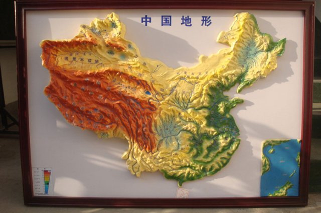
The top of this four-step”staircase”is the Qinghai- Tibet Plateau,Averaging more than 4.000m above sea level,it is often called the “roof of the world.”Rising 8.848m above sea level is Mi.Qomolangma.the world’s highest peak and the mnain peak of the Himalayas.
The second step includes the Inner Mongolia, Loess and Yunnan-Guizhou piateaus,and the Tarim. 59 Junggar and Sichuan basins,with an average elevation of berween 1,000 m and 2.000m.
The third step,about 500-1,000 m in clevation,begins at a line drawn around the Greater Hinggan.Taihang,Wushan and Xuefeng mountain ranges and extends eastward to the coast. Here.from north to south are the Northeast Plain.the North China Plain and the Middle-Lower Yangtze Plain.Interspersed amongst the plains are hills and foothills.
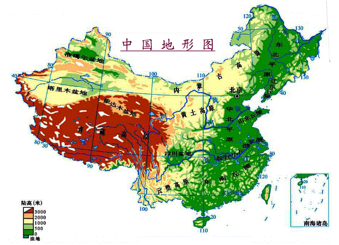
To the east.the land extends out into the ocean,in a continental shelf,the fourth step of the staircase.The water here is less than 200 m deep.
China abounds in rivers.More than 1.500 rivers each drain 1,000 sq km or larger areas. More than 2.700 billion cu.m.of water fiow along these rivers,5.8 percent of the world’s total. Most of the large rivers find their source in the Qinghai-Tibet Plateau,and as a result China is rich in waterpower resources.leading the world in hydropower potential.with reserves of 680 million kw.