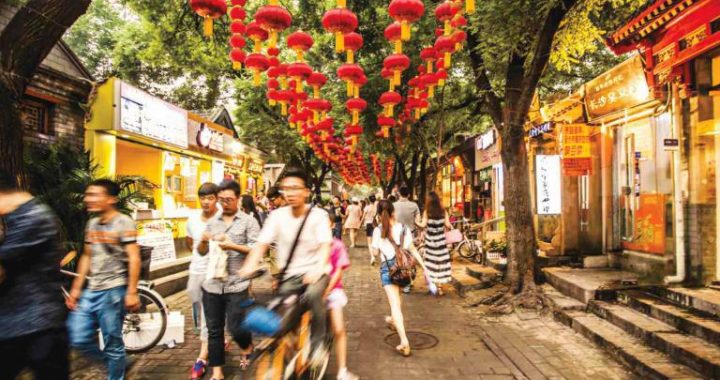
Ancient way on the beijing plain
4 min readThe entrance to the northeastern mountains is called gubeikou Pass.starting from Gubeikou Pass and going northeastward in the mountains,one would cross a chain of hills in undulation and finally reach the northeast China plain Besides,there is another way leading to Northeast China.If one started from the Beijing Plain and went onward in an eastern direction along the southern edge of the Yan Mountains,he would come to the juncture of the mountain and the sea,which is now well-known as Shanhaiguan Pass(Mountain-Sea Pass).Getting out of Shanhaiguan Pass and walking northeastward along the coastal corridor,one could come to the plain located in the lower reaches of the Liao River From the above-mentioned facts,we can see that when one got across the ancient ferry on the Yongding River in the old times,he could take three different ways onward.Then here arises a very interesting question:Where was the actual juncture of this ancient road?
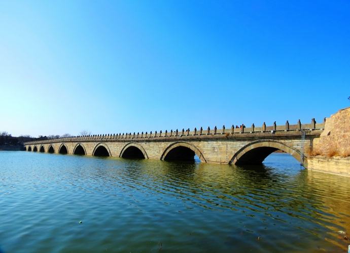
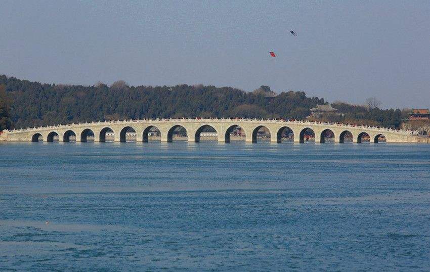
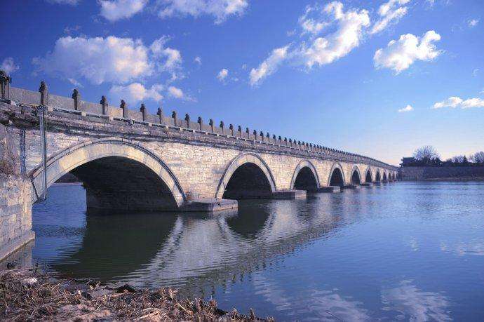
Under normal circumstances,the juncture of this road should be at this crossing site itself.As a ferry-place the point of crossing was in effect a hub of communications.With the development of social economy and the ever-increasing exchange of commodities such kind of the crossing site would provide favourable conditions for the growth and expansion of cities.This is not rare in the history concerning the development of cities in the world.One of the typical examples is the growth of the city of London which was built on the basis of an ancient crossing place on the Thames.If such an inference was reasonable,then the ancient city of Beijing should have first risen on the basis of the ancient ferry-place on the Yongding River But it was not the case.the ancient city of beijing did not first start there instead of a city,a big stone bridge made its appearance there in 1192.In some Western historical documents,this big stone bridge was called”Marco Polo Bridge”,for Marco Polo, the famous traveller from Venice was the first well-known guest from the West who had ever crossed the bridge. this eleven-arched bridge is 266. 5 metres in length This bridge is noted for its magnificent structure, graceful ornament and delicate carving. Marco Polo made detailed descriptions of it in his famous travelling notes. As a result, it became known to the west.
In Chinese, this big stone bridge is called”Lugou Bridge, which was after the original name of the Yongding River. Now the name of the river itself has long been changed, but the bridge across the river as well as its old name has always remained unchanged, and well-preserved. Here I’d like to mention one thing in passing. It is at Lugou Bridge that the Japanese imperialists launched their aggressive war against the Chinese people on July 7, 1937. That is the famous Lugou Bridge Incident The ancient ferry-place on the Yongding River, running under the present “Lugou Bridge”, provided favourable conditions for the development of a city. However, it had its disadvantages to the growth of a city at this very point as well. That was the threatening floods of the Yongding river. This is the reason why people altered the name of the river into”Yongding”, whose literal meaning is Tranquility Forever showing the hope that the river would always remain tranquil and never overflow its bank.
The Yongding river, as a big river, had an unsteady rate of flow. In the rainy season, the Yongding River rose higher and higher, swelled by the water running fromthe mountainous areas which were to the northwest of the Beijing Plain. Such ancientferry-place as the crossing site where the present Lugou Bridge is situated stood in the way of the seething and rolling waters. The floods formed a constant menace and an incessant danger to the crossing point in the old times. The ancient people decided that they shouldn’t build their city in such a place. They should have their city built up in a place which was close to the crossing site and free from the threat of floods. the place they found was the site of the original settlement which later turned into the city of Ji. As it was located at a hub of communications linking the north and the south this place had more favourable conditions than its neighbouring settlements That is why it could develop into a city at a greater speed Besides, the original settlement of Ji also had its own local and regional favourable conditions which enabled it to grow up smoothly in its early stage. For instance, it was positioned on a ridge of the alluvial fan formed by the ancient Yongding river Moreover, it was situated to the east of a belt of overflowing phreatic water near the alluvial fan. In this area, there were rich sources of water underground. To the west of the city of Ji there was a lake formed by the overflowing phreatic water. It was called the West Lake in the past and is now called the Lotus Pond. The lake led to a stream which ran through the southwest part of Ji City. The small river provided a good source of surface water for the early development of the city of ji From the analysis made above, we can see that the rise of Ji city depended not only on the decisive factors for the social and economic development, but also on the favourable geographical conditions of its own. As these geographical conditions existed objectively, their analysis is possible. If we ignored these geographical conditions, we would find it difficult to explain why the original settlement of Ji should have risen up in this very place.