A large project-kariz
3 min readThe rapid water, flowing down from Mt. Tianshan or Kalawucheng mountainous area, disappeared soon after flowing out of the mountains. Most of them leaked into the gravel in the desert, becoming underflow, before flowing to the loess land which was suitable for human habitation and livelihood. If people wanted to obtain this water and protect such preciouswater from being absorbed by sand and gravel, they had to build channels of leakage proof and erosion proof. Due to the terrain of a pan with concavedbottom, the slope was obvious and the water is rapid. The open channels had been built with high requirements of erosion and leakage proof. Without the solid channel as long as several tens of kilometers, the water couldn’t be introduced to the cultivated land in oases. In the ancient times, it was a project which was hard to be done. However, if people built the closed conduits according to the terrain of the basins and downstream, in order to make the undercurrent flow to the bottom of the basin along a man-made and relatively mild channel, they can bring water to the ground conveniently.
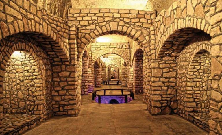
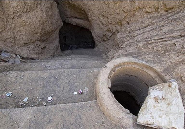
Kariz was a kind of underground closed conduit which brought water to the depth of the basins for gravity irrigation. In the project, the major facilities were the vertical wells and underground channels to connect the vertical wells.The experienced workers chose the out flowing belt of the underground water to dig vertical wells in succession. They used such vertical wells as outlets to dig underground canals. Vertical wells and underground canals became thetools to attract and accumulate the leaked water in the Gobi and gravel naturally, the vertical wells were dug every twenty or thirty meters and the underground canals were connected with each other. By doing so, the leakecwater along kariz and in the surrounding sand could be absorbed. The more the underground water gathered, the deeper the basins would extend and the shallower the vertical wells would be. The deepest vertical wells on the highest land could be sixty or seventy meters, and near the water outlet, the verticalwells were almost close to the ground. The vertical wells in this section had different effect from that in front of the mountains. Because the vertical wells were shallow, and couldn’t reach the aquifer of the underground water, therefore they certainly lost the effect of accumulating underground water but only the effect of delivering water left. Deep in the basins, the underground channels already reached the ground, and then without any tools, the clear and clean underground water could flow to the ground through the year and form the small dams for storage of water.
Kariz like this was normally three or four kilometers long and some even as long as over 10km. Through the natural filtration of kariz wells, the waterquality was good and it was promising for husbandry and human drinking or agricultural irrigation because it was warm in winter and cool in summer.A place of aridity and high temperature like Turpan Basin, the water resourceswere extremely precious, thus the kariz projects took advantage of the water to the most extent and prevented the strong evaporation of water.
The kariz project was extremely hard. The excavated earth was a hundred or several hundred cubic meters to dig one vertical well of several tens of meters deep. One kariz had several tens or even several hundred vertical wells.In addition to the underground channels extending for several kilometers, what a huge earthwork project! In the ancient times, these earth and gravel were dug by human hands, to dig with shovels and picks, to lift with baskets. And the only machine was windlass. For Turpan Basin, the kariz wells of 1,000 or so had underground channels of over 3,000km at least. In addition to the vertical wells, how huge the project was!