The Six Great Bends of the Yellow River
4 min readIn the Chinese literatures,people like to use the word”Jiuqu-luanghe””(Nine bend Yellow River”)to describe the Yellow River.The”jiu”(nine)here is only an abstract word,not meaning that the Yellow River has exactly nine bends,but a means of rhetoric in the ancient Chinese,emphasizing that there are many bends in the course of the Yellow River.
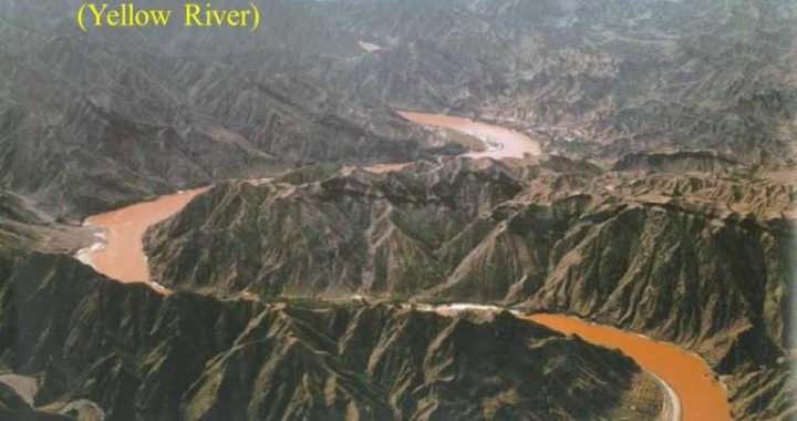
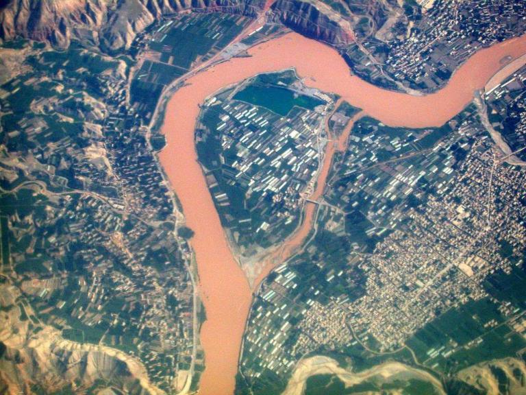
From the headstream to the river mouth,numerous big or small bends form the shape of the Yellow River-a large Chinese character”几”.Despite the bends,the overall direction of the Yellow River is from the west to the east.The factual length of the Yellow River is 5,464 kilometers;however,the straight distance between the headstream and the river mouth is only 2,068 kilometers,so the factual length is 2.64 times of the straight distance.A proverb goes that”the Yellow River has 99 bends”,while in fact the number of bends of the Yellow River,big or small,is numerous.However,with an angle larger than 45° there are only six,among which three are of 180°,two are of 90° and one is of 45°.These six bends compose the famous”Six Great Bends of the YellowRiver”.
1)Tangke Bend
Tangke Bend is located near the border area of Qinghai,Sichuan and Gansu provinces in the upper reaches of the Yellow River.After emerging from the source valley,the Yellow River roughly flows from the northwest to the southeast and then turns to flow to the southwest again after going round of Anemaqen(Amne Machin)Mountains(Jishi Mountain),thus a large bend of 180° is formed.Since the point of the bend is in Tangke Town of Ruo’ergai County in Sichuan Province,this bend is given the name Tangke Bend.And Tangke Bend is also called the”First Bend of the Yellow River”because its location is near the headstreamof the river.
2)Tangnaihai Bend
Tangnaihai Bend is situated in the east part of Qinghai Province.After going out of Tangke Bend,the Yellow River continues to flow to the northeast along the valley between Anemaqen(Amne Machin)Mountains and Xiqing Mountain.When it passes the counties likelaqin,Tongde,Xinghai,Guinan,Gonghe and Guide,the river begins to turn to the southeast gradually,hence the second large bend of the YellowRiver.
Since the point of the bend is in Tangnaihai of Xinghai County,it is called Tangna ihai Bend.
3)Lanzhou Bend
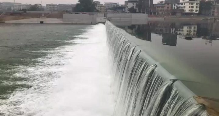
The most famous bend on the Yellow River must be Lanzhou Bend,because it is the area on the Yellow River that the hydroelectric power stations are most concentrated.The stations that have been built on the Yellow River like Longyang Gorge,Lijia Gorge,Liujia Gorge,Yanguo Gorge,Bapan Gorge and Qingtong Gorge are a1l in this region.Lanzhou Bend is located between Tangnaihai Bend and Hetao Bend,and it is linked up by 4 small bends.The river first flows towards the east and then turns to the north,forming a bend about 90°.The turning point is near Lanzhou,so it is called Lanzhou Bend.In the section of this bend,the Yellow Rivercourses past the west end of Qinling Ranges,the east end of Qilian Mountain,northof Liupan Mountain and Longxi massif.The directions of the river and the mountain ranges are almost perpendicular to each other,forming many river valleys that alternate with river and gorges.There are more than 10 main valleys and,because of the hard rocks here and the large drop of elevation,the waterpower resources that can be exploited are very rich;therefore it becomes an area with many hydroelectri power plants on the YellowRiver.
4)Hetao Bend
Hetao Bend is the one that located most northward of the six bends.After passing Lanzhou Bend,the Yellow River continues to flow northward and then turns to the east in Inner Mongolia Autonomous Region,traversing the whole Hetao Plain.Then it turns again to the south in Tuoketuo County and enters Jinshan Gorge,forming a 180°large bend at the top of the”几”.
Hetao Bend flows past four provinces and autonomous regions, namely, Ningxia HuiAutonomous Region, Inner Mongolia Autonomous Region, Shanxi province and Shaanxi province. The interior region of Ordos Basin that is surrounded by Hetao Bend has an area of over 40,000 square kilometers, about 5.6% of the total drainage area of Yellow River, so we can see how large the bend is.
5) Tongguan Bend
Tongguan Bend is a large bend of 90° that is formed by a sudden turn to the east in Shaanxi Province after the Yellow River gets out of Yumenkou and flows southward to Weifen Rift Valley. Afterwards, the Yellow River continues to flow along the north foot of Qinling Ranges. It is called Tongguan Bend because its point of the bend is in the old city of Tongguan County.
6) Lankao Bend
Lankao Bend is located in the Dongbatou of Lankao County in Henan Province, which is located in the middle of the Yellow River alluvial fan on the North China Plain. It is the one with the smallest angle and also flattest terrain among the six bends of the Yellow River. Because it is in the flat plain area, there occurred manytimes of course change of the Yellow River in the history, and the river course now was formed after the levee in Tongwaxiang was breached in 1855. In a long time before the breach, the Yellow River always flowed to the east and, passing Kaifeng and Shangqiu, it took over the river course of Huaihe River near Xuzhou and entered Huanghai Sea; after the breach, the Yellow River turned to flow towards the northeast, and formed Lankao Bend, which was about 45, in the Dongbatou area of Lankao County in Henan Province.