The Reasons of Course Change
4 min readChina has over 9.6 million square kilometers of land, on which flow numerous rivers. Then why the Yellow River, especially its lower reaches, would change its courses so frequently, while other rivers not? For thousands of years, this problem always puzzled the Chinese people, and the Chinese ancestors also did much research about this problem. However, being limited by the science, technology and instruments then, although people got some explanations, they were only a small partof the secret of the Yellow River. The development of modern technology provides us sufficient conditions to investigate into the Yellow River.
Through careful observation and repeated contrast research, people found that every river has an ability called “automatic adjustment ability”. In another word, the lower reaches of the river, in order to adapt to the amount of silt, sand andwater volume from the upper reaches, adjust itself from time to time, for examplechanging the span of the riverbed, the depth of the water, the bend degree of the river course and so on, or changing its drop in elevation to adjust its silt carrying ability, to keep the balance of the river course. When the silt and sand from the upper reaches exceed the capacity of the river, the river course will be silted up. And after the silting, its slope increases, thus increase the silt carrying ability of the river; and when the sand and silt from the upper reaches is less than the sand-carrying capacity of the river, scouring will occur, which willresult in the decrease of the slope of the riverbed, correspondingly reducing the sand-carrying ability of the river. However, everything has its limit, so does the automatic adjustment ability of the rivers. When reaches its limit, that ability will not function any more. In that case, the river will keep silting up or scouring.
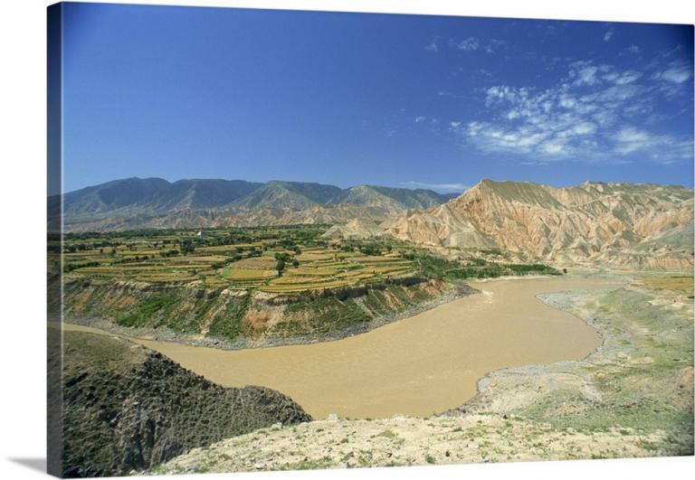
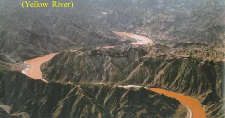
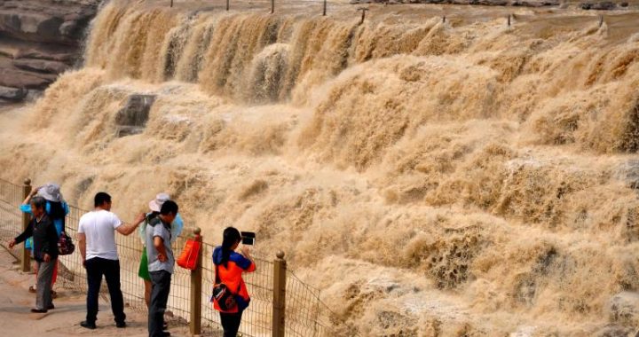
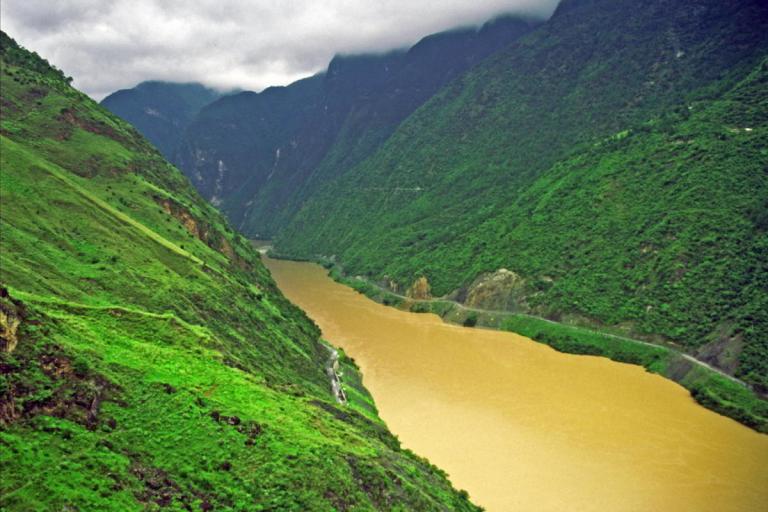
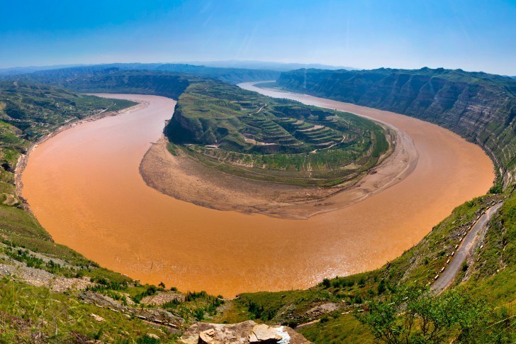
The lower reaches of the Yellow River are a typical example of the river reaching its automatic adjustment limit and keeping silting up. It’s also world famous for its frequent silting, breaches and course changes. The reason of its frequent silting is that the large amount of silts from the upper reaches exceedsthe sand-carrying capacity; frequent breaches are partly due to the abundant watervolume of certain years, and partly are caused by some human causes. Frequent cours changes mean that the river course of the lower reaches often move back and forth, quite uncertain. Not only the mainstream but also the whole river course has undergone large changes.
People also found that the three phenomena have certain cause-and-effect relationship. The long-time silting of the river course results in the rise of riverbed and the water level rises accordingly, which adds largely to the possibility of breach; once the levee is breached, it certainly will lead to the change of river courses; and the newly formed riverbed is usually much lower and the earth in the basin is usually very loose; in addition, the silt and sand from the upper reaches are carried down continuously, therefore silting becomes the inevitable tendency. Silting, breach and course change, the three moved in a circle, influencing the development of the Yellow River and also the Chinese people living in the YellowRiver Basin.
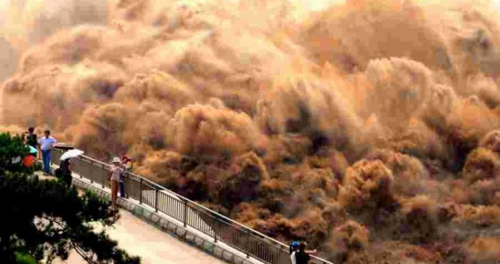
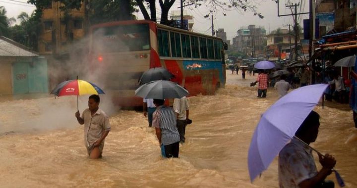
Every time when breach, flooding and course change of the Yellow River happens it imposes enormous influence on the geographic environment of the plains in the lower reaches. The surging water after the breach will swallow stretches of lands, claim millions of people’s lives, destroy their properties and wash many cities and towns into ruins. After the floods withdraw, what left are vast desert. Under the effect of the winds, there appear many sand hills and sand ridges, which swallowfarmlands, submerge houses and obstruct traffic, affecting people’s normal work and life greatly. The many sand hills, sand ridges and large stretches of saline and alkaline lands that distribute in the northeast and east part of Henan Province are the results of the flooding of the YellowRiver.
The frequent breaches and course changes of the Yellow River also directly changed the water systems on the Huanghuaihai Plain. According to the historic records, the Huanghuaihai Plain in the ancient time presented the scene of interweaving network of rivers and lakes. However, after the flooding, scouring and silting of the Yellow River from time to time, many rivers became more and more shallow, and some of which even dried up completely; many lakes, after the silting of the Yellow River, became shallow marshlands and were reclaimed to be farmlands.
These situations also caused dry climate and water shortage in the local area. Meanwhile, the silts in the Yellow River deposited everywhere the river flowed, which indirectly led to the elevation of Huanghuaihai Plain at large.