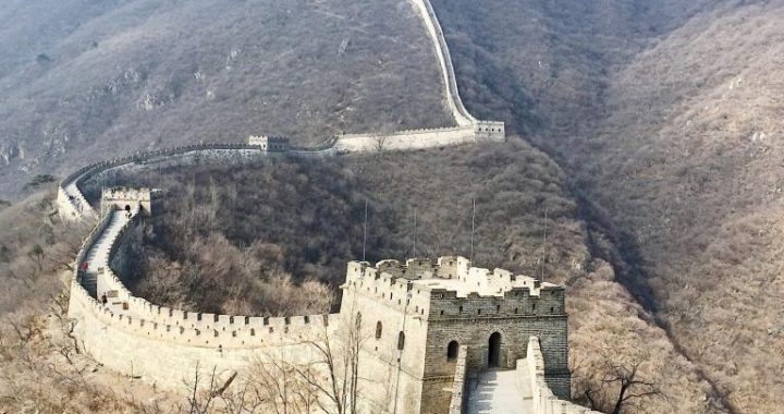
The Qin Shi Huang Great Wall
4 min readThe Qin Shihuang Great Wall could be roughly divided into three sections,the east one,the middle one and the west one.
The general run of the east section was as follows:it started from Huade county in Inner Mongolia Autonomous Region,going east and passing Kangbao county in Hebei province,Taipusi Banner in Inner Mongolia Autonomous.
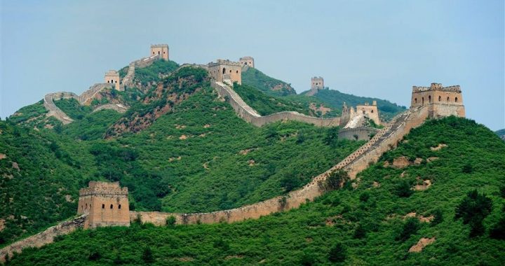
Region, the south of Duolun county, Fengning in Hebei province, the north of Weichang county, the north of Chifeng city and the south of Naimanyukulun Banner in Inner Mongolia Autonomous Region, and then it reached the north of Fuxin city in Liaoning province. This section of the Great Wall might be rebuilt on the basis of the Northern Yan Great Wall built in the Warring States Periods(475BC-221BC) or the new construction by the Qin dynasty (221 BC-206 BC). In the east of Liaohe River, according to the historical literatures, the Qin Shihuang Great Wall extended till the north bank of Datong River in the territory of the North Korea, but no obvious sites are found there. Since the natural conditions of the areas passed by the east section were quite different, the construction of the Great Wall had to use the local materials, adopting the methods of “making use of the strategic positions in building passes”and “laying stones to the fortress and planting elm woods to be the pass”etc. The Great Wall in Chifeng, Weichang and Fengning areas was usually built on the mountains, so it was built by the naturalstones in the local area, accounting for about 50% of thelength of the Great Wall that had been investigated. The interior and exterior sides were all built with relatively regular and large stones, and the middle part was filled with irregular stones or gravels. Its foundation was usually 2 to 3 meters wide, and the cross-section of the wall was a shape of trapezium, wider in the bottom and narrower on the top. The wall was about 3 to 4 meters high in estimate at that time, and the width of the top was about 1 meter. On the remained foundations of the stone walls, there are some obvious seams in some sections, indicating that the Great Wall was constructed in divided sections at that time.
The general run of the middle section was as follows: it started from the north of Xinghe county in Inner Mongolia Autonomous Region, going along the north bank of Huangqi Sea and went round the north part of Jining City.
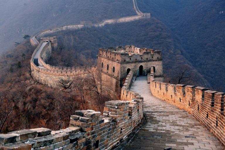
Then it extended to the west along Daqing Mountain and passed Cayouzhong Banner, the south of Wuchuan county, Damiao, Yinhao and Xidoupu in the north of Guyang county. After that, it crossed Wuyuan and the north area of Hangjinhou Banner, where the wall was between Yinshan Mountain and the Yellow River. At last it reached Wulanbu and the north border of the desert in the west. This middle section of the Qin Shihuang Great Wall made use of part of the old Northern Zhao Great Wall built in the Warring States Periods(475 BC-221 BC), but there was also much that was newly built. The body of this section was built by laying stones, and fortresses were built beside the important passes, and also beacon towers in the area good for observation and keeping a lookout. The huge project and its grandeur were all incomparable by the common earthen wall in the Warring States Periods(475 BC-221BC). The parts which are well-protected have an average height of 5 to 6 meters and 3-meter-wide top; and in every1to 2 kilometers there is a small beacon tower, and in every 5 kilometers there is a large beacon tower and a garrison barrack.
The west section was built along the Yellow River and it was mainly composed of fortresses and passes, but not a Great Wall with all sections connected. In the Lintao area, we can still see the remaining walls off and on, like a flying dragon. There are also some local places with the names of”Changchengpo”(the slope of the Great Wall) and”Changchengkou”(the beginning of the Great Wall).

And judging from the fact that the Qin Zhaowang Great Wall which used to traverse Gansu province, the south of Ningxia Hui Autonomous Region, the north of Shaanxiprovince and Inner Mongolia Autonomous Region from the southwest to the northeast had lost the function of defense at that time, we could infer that the west section of the Qin Shihuang Great Wall was not built on the basis of Qin Zhaowang Great Wall. Therefore, the site of this section of Great Wall needs further investigation. Emperor Qin Shihuang’s policy of “making use of topographical advantages in building passes”in building the Great Wall demonstrated itself in that the Great Wallwas largely constructed on the mountain ridges, and usually the inner side of the wall was the relatively gentle slope; in the parts the Great Wall crossed the river valleys, the workmen sometimes used moats to replace walls and sometimes built a parallel wall at one side of the river valley; and between two mountains the workmen would built a stone wall with the natural stones, forming the strategic places of”stone gate”; in addition, in the places where the Great Wall passed the main road in the valleys, the workmen usually built a “in-the-way”pass, composed of a stone construction or a construction mixing with stones and rammed earth, just like a dam which enclosed the reservoir in the mountains, and fortresses were also built beside the passes. All these measures helped greatly strengthen the defense function of the Qin Shihuang Great Wall.