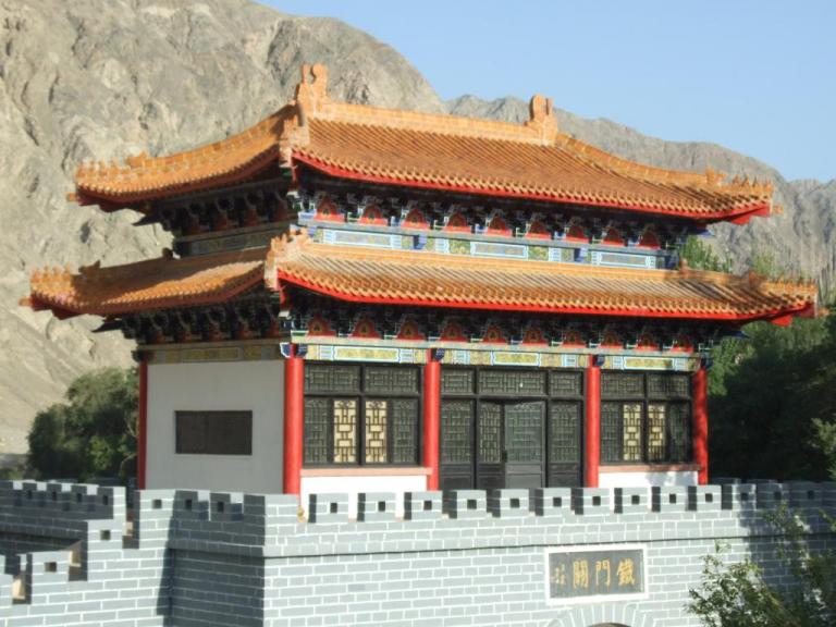
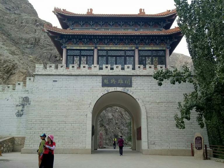
Iron gate pass
2 min readThe Iron Gate Pass lies between Kuerle Municipality and Tashidian Countyof Bayinguoleng Mongol Autonomous Prefecture On the upper reaches of the Peacock River lies an outlet with a length up to 17.8km which is considered as one of the important passes connecting the north and south Xinjiang and also one of the important sites where soldiers guarded their boundaries by its steepness in Chinese history.
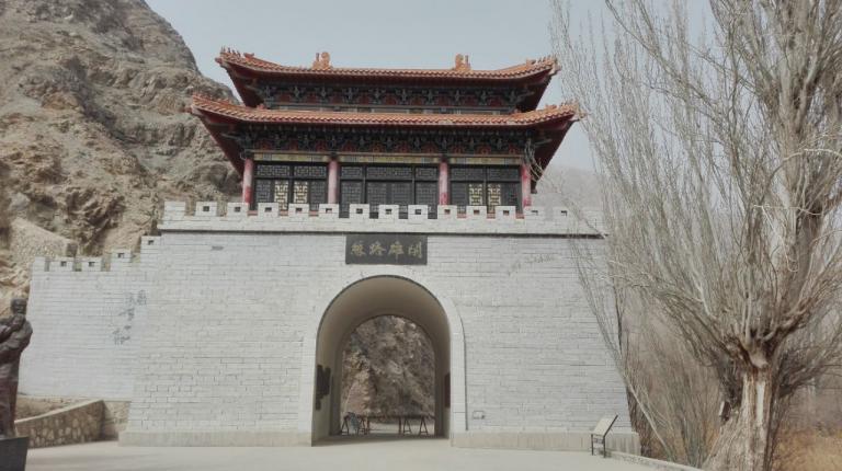
Two mountain ranges lie at the iron Gate Pass with the southwest at the Hora Mountain and the northeast at the Kuruk Mountain, both ending between Kuerle and Tashidian, so there is a big valley which is over 10kmbetween the places with the Peacock River breaking through it and runningtowards the south Kuru the two sides of the extremely steep valley are of around one thousand two hundred or three hundred meters a bove sea level and the distance between which is only fifty to a hundred meters. The steep cliffs accompanied with twists and turns with the south bank of the river being wedged up against the cliffs have a width of three to four meters, so people who walk here and look up at the cliffs which line up with the sky may feelimpossible to escape and even be scared at the swift and surging streams inthe Peacock River at the bottom of the valley. ancient people set up a passbetween Kuerle municipality and tashidian county and controlled the road so as to check passers-by just as an iron gate, hence the name of the pass.
The moving story of tahir and Zhuohela committing suicide for freedom and love is popular among people in Xinjiang and Central Asia, and their graves are on the princess hill across the iron Gate Pass for people to visit and ponder on.