Flow on Forever, the Chanhe River and the Bahe River
6 min readI and the Bahe River, and destined to be together, just as the river and the city of Xi’ an All throughout the passing of seasons, flowers blossom and wither, although seasons and dynasties change, the river Bahe and Xi’ an were always together. The city, too has not forgotten the river, as depicted by the popular saying “Win or lose,I will always be with you”.
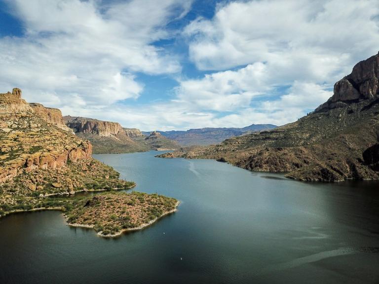
When speaking of the city of Xi’ an, it is the Qinling Mountains that we must mention first. When I was a little boy,I was often told by the elderly elders that,”All those Emperors, generals and ministers stayed here only for thebecause of the wonderful Qinling Mountain.”Up till now, I still am a avid believer in those harbor a firm belief on those deductive words.
It is not possible to find a person who grew up here, who didn’t posses deep-rooted sentiments towards the Qinling Mountains. The Qingling Mountain, resembling a great father, gazes the Weihe River winding its way eastward and protects the magical land of Guanzhong Plain.
Qinling Mountains, which traverses China from east to west, was named after the Qin State, for it had jurisdiction over the mountains in throughout history. To the west, Qinling Mountains is separated from the Kunlun Mountains by the Mindie Mountains; to the east, it borders the Funiu Mountain in Henan Province; to the north, its western part starts from Baishi Mountain in the north of Lintan Couty to the southeast of Tianshui City, or to the hilly area on the south bank of the Yellow River; to the southwest, its border coincides with the province boundaries of Gansu and Sichuan Provinces; and to the south, it meets the Han River, Micang Mountains and Daba Mountain. Spanning over 1600 kilometers from east to west, measuring in width from tens of kilometers, to approximately three hundred. The Qinling Mountains has an area of about 120,000 square kilometers.
Qinling Mountains, as a natural north-south defense, is the dividing line between the north and south of continental China in terms of physical geography. An isotherm of zero degree traverses the Huaihe River-Qinling Mountains range. The areas north of the isotherm have a climate that is warm and temperate, humid or sub-humid, while the area south of it, is subtropical and moist. The climate difference renders diverse landscapes at the north and south of the Qinling Mountains. Areas north of the Huaihe River-Qinling Mountain range features warm-temperate mixed coniferous broad-leaved forests, deciduous broad-leaved forest, mountain brown soil and cinnamon soil, while areas south of the line are covered by sub-tropical deciduous broad-leaved mixed forests containing species of the evergreen broad-leaved trees, yellow-brown soil and yellow-cinnamon soil.
As commented in Shihchi by Sima Qian:”The Qinling Mountains is the world’s largest natural barrier.”Qinling Mountains constitutes the boundary for conflicts that occur between the ancient states south and north of it. This is true for the Three Kingdoms, namely, Wei, Shu and Wu, the Sixteen Kingdoms of the Eastern Jin Dynasty, the Northern and Southern Dynasties as well as the Dynasties of Song, Liao and Jin.
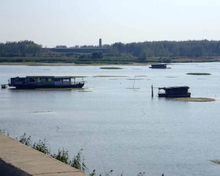
In my free time,I am especially fond of browsing maps, and would mark the scenic points on it, to which I would assign a appropriate namethat is characteristic of the country. However, these are my findings. The water, which originated from the Qinling Mountains, when it flowed southwards is all called”Jiang”in Chinese, such as the Hanjiang River and Jialing River, while the water that flowed northwards is called “he”in Chinese, which includes the Bahe River and Chanhe River, upon its banks, I lingered in my childhood.
Over the years,I travelled a lot.I’ ve admired the sunset seen from theRiver Nile, experienced the romance of the Seine River, sampled the long history of the Rhine, and enjoyed going boating on the cold waters of the Volga River. So, in essence, my dream of travelling ten thousand miles has been fulfilled to some extent. All these famous bodies of waters that are called rivers, reminds me of the Bahe River, which can be famous too. Though soo tiny compared with these other rivers, the Bahe River carries with it unspeakable meanings and sentiments for people who were born and lived along its banks.
Rising from the denudation surfaces of the fault-blocks areas of Mount Hua, the Bahe River twists its way westwards via the Bayuan County and meanders through the Languan Valley located on the west side of the fault blocks all the way to the Languan Town, where it joins the Weihe River.
Running a length of 109 kilometers, the Bahe River has a drainage area of 2581 square kilometers, with an average width of 29.3 4kilometers.
The Bahe river has 24 tributaries flowing directly into the main stream,26 secondary tributaries and 11 tertiary tributaries. Dropping a total of 1080 meters, it has a water energy resource reserve of 119251.62 kilowatt, of which 70566 kilowatt can be used. The plain valley, through which the Bahe River flows is 4 to 6 kilometers in average width, reaching 10 kilometers in its widest at the Languan Town seats. At the leftmost banks of the river, instead of terraces, steep slopes prevail. This is especially true with the areas around the Languan Town to the Maoxi Village, where the river drops over creating a slope in excess of 100 meters, directly off the White Deer Plain. In contrast, the right bank of the river boasts a four step terrace, which consists of a broad valley makes developed agriculture possible.
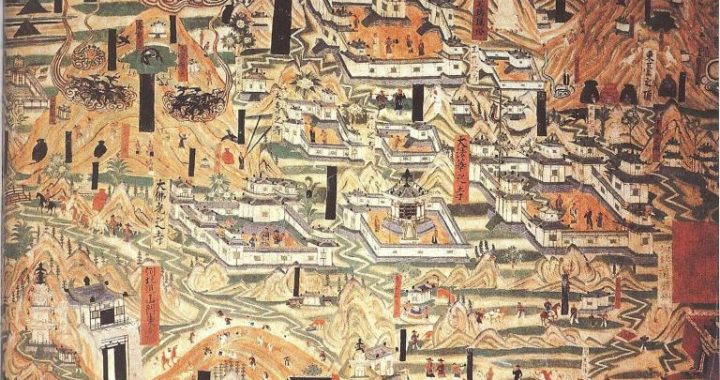
historically though being just a tributary of the Weihe River. During the period of the Sui and Tang Dynasties, there were boats commuting on the river and the Ba Bridge, was full of people and vehicles, and was know far and wide, and was testament for that prosperous era. Alongside the banks of the Bahe River grew weeping willows, the exuberant trees and the radiant water and were engulfed in an enchanting mist. In ancient times, people living in big cities would express farewell with each other with an osier, thus creating many humanistic yet interesting poems depicting the Bahe River, the Ba Bridge and many depictions of the willows growing there.
Being the largest tributary of the Bahe River, the Chanhe River originates from the south of the 2000-meter-high Ziyun Mountain which is located to the north of the main maintain of Qinling Mountains. Itmeanders over for 63.5 kilometers to the aheB River at the Ba Bridge area, passing the White Deer Plain, Wei Village, Nadai Dayu River and Kuyu River. Running 63.5 kilometers, its drain basin covers 760 square kilometers, and is 11.7 kilometers wide on average while being 21.3 at its widest. The Chanhe River discharges 130 million cubic meters of water annually, with a rate at 4.194 cubic meters per second. It has a water energy resource reserve of 45267.222 kilowatt, out of which 26156 kilowatt can be used.
Although only a tributary of the Bahe River, the Chanhe River enjoys equal popularity. It has been historically said that “Xuan Ba Su Chan”, which means that the Bahe River is broad in area, and large in discharge, while the Chan is clear and beautiful.
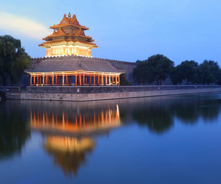
The Chang’ an city in the Tang Dynasty was mainly fed by the Chanhe River, with most of the water for large pools and ponds were sourced from, such as the Qujiang Pool. It is recorded that, during the Tang Dynasty, the Huang Channel was dug to divert water from the Chanhe River to Qujiang forexpanding the latter. Pavilions, terraces, towers, pagodas and other pavilions had also been built around the pool. Majestic and exquisite, large or small, these places of historic relevance and cultural heritage complemented each other, making Qujiang,a scenic area, and het locations around the Qujiang Pool,a famous tourist attraction within the south of Changan. In addition, the Longshou Channel was constructed to channel the water from the Chang river to the former Matengkong Village to the northwest of Changle Slope. It was divided into two sub-channels, the east channel and west channel, which provided water for the imperial palace.
The east channel flew through the northeastern outskirts of Chang’ an and then turned west into the Yu Garden, while the west channel ran into the city via the south of the Tonghua Gate, and entered the imperial palace and emptied into the East Pond after passing the streets of Yongjia, Xingqing, Shengye and Chongren.
The dynasties that followed, Song, Jin, Yuan, Ming, Qing, all had renewed and repaired the two channels. Therefore, it can be said that the Chanhe River had played an important role in delivering water for the city of Chang’ an.