The Secret of the Riverhead
6 min readThe Chinese civilization enjoys a 5,000-year-old history, which could trace back to the Paleolithic Age; since then and till the appearing of oracle bone inscriptions in the Xia and Shang dynasties (2070 BC-1046 BC), the middle and lower reaches of the Yellow River were always the center of the development and prosperity of the Chinese civilization. In the ancient times, the productivity is very low; in order to live, the ancient people had to work laboriously for food through agriculture, stockbreeding and fishery, with no time or energy left to explore theworld out of their living place. Even if there were someone who wanted to explore the source of the Yellow River, it was impossible due to the limitations of traffic and practical conditions of that time. Till the Spring and Autumn and Warring States Periods(722 BC-221 BC), the State of Qin, which located at the west of China, expanded its border westward and had a beginning understanding of the riverhead.
Discussion on the Tribute of Yu,A Chinese Bestiary and other literatures then took Jishi Mountain and Kunlun Mountain as the source of the Yellow River, which, although far from the truth, was a great progress at that time, given various kinds of limitations.
In the middle Western Han dynasty (206 BC-25 AD), in order to enhance the communication with the nationalities in the west and cement his reign, Emperor Wu sent Zhang Qian as the envoy on a diplomatic mission to the Western Region (including present-day Xinjiang Autonomous Region of China and Central Asian). This was the first time that the official sent by the imperial court of the Central Plains established direct relations with Western Region through Hexi Corridor, and it was also an epoch-making event in the China-Western Region transportation-ZhangQian’s mission to the Western Region established the foundation of the “Silk Road” which traversed European Continent and Asian Continent afterward.
After Zhang Qian returned to the Central Plains, he reported to the court a piece of important geographic information-the people in Western Region who lived in and around Tarim Basin generally believed that Tarim River flowed into the underground in the desert then flowed to the east in the form of undercurrent till Jishi Mountain, where it reappeared on the ground and became the Yellow River. This was originally a speculation with a tint of legend, however, Emperor Wu took it as true; in addition, the ancient literatures had the statements that the Yellow Riveroriginated from Kunlun Mountain, therefore the emperor took Kunlun Mountain as the source of Tarim River mistakenly and since Yellow River was formed after Tarim River flowed into the underground in the desert, hence the statement of “chongyuanqianliu”(“chongyuan”means two rivers are of one source, and””means a river flows into the underground) which greatly influenced the opinions of people afterwards.
After Emperor Wu of the Han dynasty (206 BC-220 AD) took Kunlun Mountain as the source of Tarim River rather indiscreetly, the false statement of the Yellow River “chongyuan-qianliu “became the written evidence of the later dynasties about the source of the Yellow River. Falsehood was taken as truth by many people then andafterward; till the late Qing dynasty (1616-1911) and the early Republic of China (1912-1949), there were still some people who believed this without a shadowof doubt.
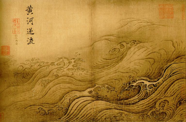
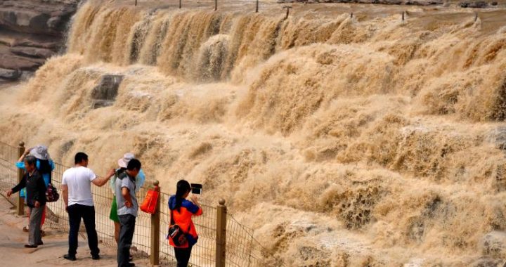
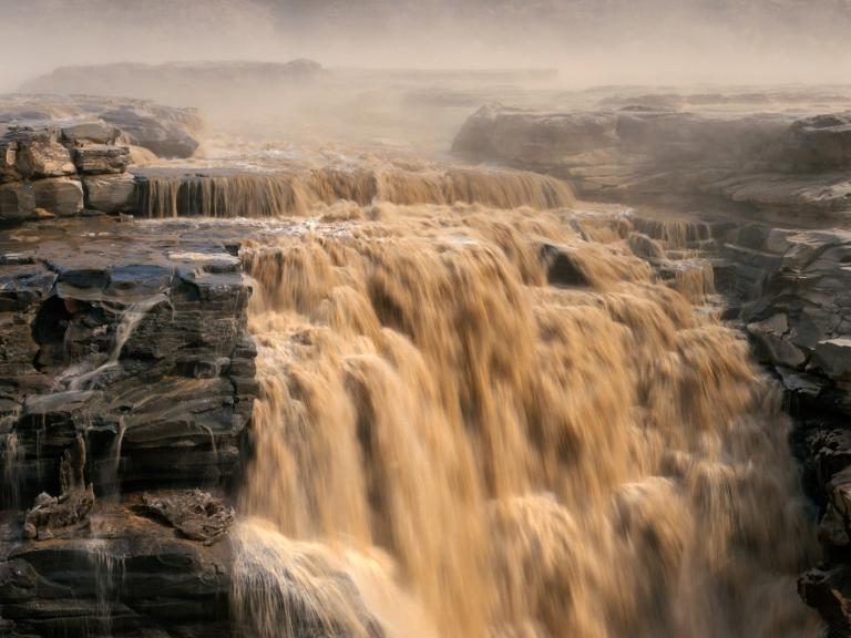
Until the Jin dynasty (265-420), people took Sungsuk Sea as the source of the Yellow River, which was a great progress compared to the vague statement of “chongyuan-qianliu”. Bowu-zhi(Records of Natural Science) written by Zhang Hua in the Eastern Jin dynasty (317-420) held the opinion that Yellow River originated from Sungsuk Sea and the water was very clear there, with a tint of red; later it received many tributaries along its way and began to become muddy.
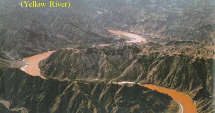
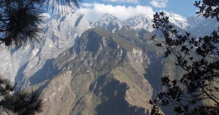
During the Eastern Jin dynasty (317-420) and the Southern and Northern Dynasties (420-589), large numbers of minority ethnics moved towards the Central Plains. With the increase of communication between Qiang people who lived in the headstream area of the Yellow River on the Tibetan Plateau and the nationalities in the Central Plains, people gained more understanding of the headstream of the Yellow River. Based on this understanding, the Sui dynasty (581-618) set up Heyuan Prefecture(Riverhead Prefecture) at the Great Bend of the Yellow River near Anemaqen(Amne Machin) Mountains in Qinghai Province of China. Although they hadn’t explored the headstream on the spot at that time, the prefecture name of “Heyuan”(riverhead) showed that people’s understanding towards the riverhead of the Yellow River was clearer.
Yellow River was clearer.
In the early Tang dynasty (618-907), because the Kokonor people who lived on the Tibetan Plateau for generations kept invading the west border of Tang dynasty, Emperor Taizong Li Shimin, in 635, appointed the famous general Li Jing as the commander in chief of Xihai Dao, together with Prince Rencheng, Li Daozong, and the minister of War, Hou Junji, to lead the army for a punitive expedition. The expedition army, conquering various difficulties, went all the way to the Tibetan Plateau. Since the Kokonor people hadn’t expected that the Tang troops would arrive so quickly, their army was defeated at once. In order to chase the defeated Kokonor people, Li Jing and his army chased all the way to the riverhead area on the west of Sungsuk Sea, and they passed “Baihai Sea”(today’s Zaling Lake) in the upper reaches of the Yellow River on half way. According to the records of history, Li Jing, together with other people, saw the riverhead of the Yellow River near Sungsuk Sea. This was the first time that people from the Central Plains saw the true source of the Yellow River. Although further investigation was impossible for Li Jing and other people because of the war, this action established important bases for the later people to further understand the riverhead.
In 641, Princess Wencheng, the daughter of Emperor Taizong Li Shimin of the Tang dynasty (618-907), was married to the king of Tubo, Songtsan Gampo, who lived on the Tibetan Plateau. Songtsan Gampo, leading his subordinates and subjects, received Princess Wencheng and the team in person near the riverhead. After 180 years, in 821, the emperor sent the chief minister of Dalisi, Liu Yuanding, as the ambassadorof alignment to Tubo. In the historic literatures there are detailed descriptions about the path Liu Yuanding went, including that on the west side of “Cantian-Khan Road”(which was built by the minority ethnics in a tribute to the merits of Li Shimin) there was a mountain called “Zishan”(Purple Mountain), and the color of the YellowRiver, originating fromthe mountains, began to become dark red from its original limpidity. Therefore, the riverhead of the YellowRiver that the Tang people recognized might just be Kari Qu-the true riverhead that nowhave been confirmed. And the so-called”Zishan”was in fact the Bayan HarMountains in present day.
Three years after the foundation of People’s Republic of China, in August 1952, a riverhead inspection team organized by the Yellow River Hydrology Committee sti1l took Yueguzonglie Qu as the real headstream of the Yellow River. In the 20 years afterwards, many people questioned this conclusion. In order to make clear where the real headstream of the Yellow River lies, the Chinese government organized a riverhead inspection team again in 1978 to go deep into the headstream area for investigation. The inspection team found that in the west of the headstream area, three rivers called Za Qu, Yueguzonglie Qu and Kari Qu entered Sungsuk Sea, among which the length of Za Qu was the shortest and its water volume the smallest, therefore it was considered as a tributary of Yueguzonglie Qu. The Kari Qu has alength of about 30 kilometers and drains an area of over 700 square kilometers, whose all statistics exceeds those of Yueguzonglie Qu, and its water volume is also over two times of Yueguzonglie Qu. Therefore, the inspection team finally concluded that it was more justifiable to take Kari Qu as the real headstreamof YellowRiver.
Till then, the dispute about the headstream of the Yellow River was solved. The headstream was confirmed officially to be Kari Qu which originates from Gezigeya Mountain at the north foot of Bayan Har Mountains. The limpid water flowing out of several springs at the foot of Gezigeya Mountain becomes the initial current of the Yellow River that “roars thousands of to Longmen (the Dragon Gate)”.