The Wall of the State of Yan the Great Wall beside Yishui River
3 min readWe know that the State of Yan was located in the north of Hebei province and the south of Liaoning province of today.It bordered upon Korea in the northeast,Donghu in the east,the States of Zhongshan and Zhao in the west and the Gulf of Bohai and the State of Qi in the east.
Later the State of Yan built Wuyang as the”lower capital”,and called Ji as the“upper capital”.
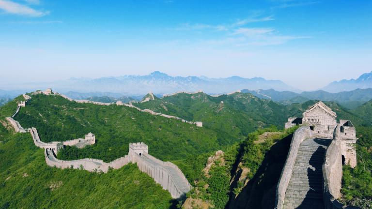
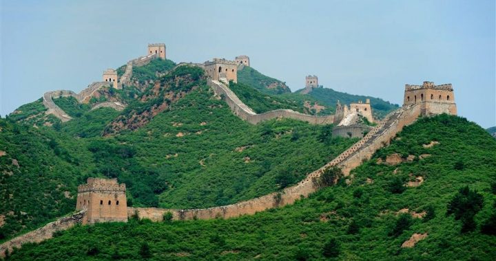
According to the investigation of the archaeologists,the State of Yan also had two walls at that time:one was in the south of the“lower capital”of Yan,on the side of Yishui River,therefore it was called”Yishui Great Wall”,and also the“Southern Yan Great Wall”as well;the other was along the north border of the State of Yan.The Yishui Great Wall was constructed solely to protect the“lower capital”of the State of Yan,Wuyang,since it was in a po-sition too close to the state’s southern border,and thusclose to the warlike States of Zhao,Wei and Qi,which the State of Yan couldn’t take lightly.According to the inference of the Historical Records,this Yishui Great Wall was built before King Zhao’s reign(311 BC-279 BC).It started from the foot of Taihang Mountain in the west,stretching eastward along the north bank of the Southern Yishui River till Xushui River.After a section of going along the north bank of Puhe River(the middle and lower reaches of the Southern Yishui River),it crossed Puhe River and turned to extend along the south bank of the river till Rongcheng city.Then it went east and crossed Pinghe River until at Anxin(which is buried by the north embankment of Baiyang Lake today).After the wall entered thearea of Xiongxian county,,it is covered by the embankment of Daqing River today.Then it crossed Daqing River and went to the southeast,and at last ended at Dacheng after passing Wen’ an.Except the section in the west end which was built by stone,the other part of this Yishui Great Wall was all stamped by rammed earth.
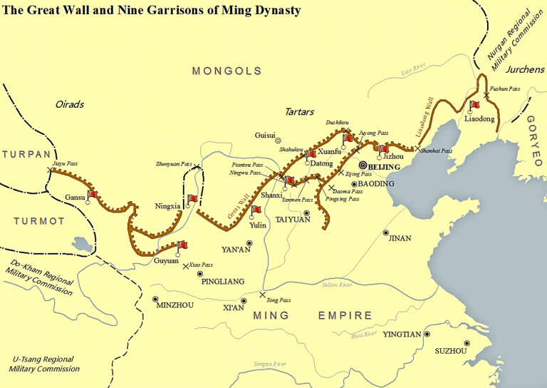
A page from Historical Records According to the Historical Records: the Account of Xiongnu, in a period after King Wuling building the Zhao Great Wall, therewas a virtuous and able general of the State of Yan, QinKai, who stayed in Donghu as a hostage in a time and wongreat respect and trust from the Donghu people. However, when he returned to his own country, the State of Yan, he led the army to attack Donghu, who was defeated and retreated for a long distance, with large stretches of land left behind. Thereupon “the State of Yan also built a wall, starting from Zaoyang to Xiangping. And it also set the prefectures of Shanggu, Yuyang, Youbeiping, Liaoxi and Liaodong to defend against the Donghu people”. That wall built was just the Northern Yan Great Wall in history. The Northern Yan Great Wall started from Dushikou in Zhangjiakou area in Hebei province, passing Guyuan, Weichang, Kalaqin Banner in Inner Mongolia Autonomous Region, Chifeng Mountain, Heishan Mountain, Laoha River in the northeast direction, and then it turned eastward and entered the hilly area in the north of Jianping county in Liaoning province, where the wall was built in very strate-gic and perilous positions. After going out of the mountain area, the wall crossed Benghe River and entered the Aohan Banner in Inner Mongolia Autonomous Region. Then it reached Fuxin county after going out of Beipiao in Liaon-ing province. Till today it has not been confirmed whether or not this wall continued to go eastward from Fuxin county and went all the way to Liaoyang(Xianping in the State of Yan).